


Washoe County (South) PUMA, Nevada
About
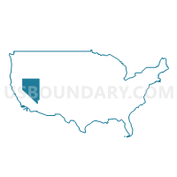
Outline
+PUMA%2c+Nevada_A280.png)
Summary
| Unique Area Identifier | 193350 |
| Name | Washoe County (South) PUMA |
| State | Nevada |
| Area (square miles) | 455.04 |
| Land Area (square miles) | 420.37 |
| Water Area (square miles) | 34.67 |
| % of Land Area | 92.38 |
| % of Water Area | 7.62 |
| Latitude of the Internal Point | 39.42530830 |
| Longtitude of the Internal Point | -119.87191770 |
Maps
+PUMA in Nevada.png)
Graphs
Select a template below for downloading or customizing gragh for Washoe County (South) PUMA, Nevada
+PUMA%2c+Nevada_T0.png)
+PUMA%2c+Nevada_T1.png)
+PUMA%2c+Nevada_T2.png)
+PUMA%2c+Nevada_T3.png)
+PUMA%2c+Nevada_T4.png)
+PUMA%2c+Nevada_T5.png)
+PUMA%2c+Nevada_T6.png)
+PUMA%2c+Nevada_T7.png)
+PUMA%2c+Nevada.png)
Neighbors
Neighoring Public Use Microdata Area (by Name) Neighboring Public Use Microdata Area on the Map
- Carson City, Lyon, Douglas & Storey Counties PUMA, NV
- Del Norte, Lassen, Modoc, Plumas & Siskiyou Counties PUMA, CA
- Nevada & Sierra Counties PUMA, CA
- Placer County (East/High Country Region)--Auburn & Colfax Cities PUMA, CA
- Washoe County (North)--Sparks City PUMA, NV
- Washoe County (South Central)--Reno City PUMA, NV
Top 10 Neighboring County (by Population) Neighboring County on the Map
- Washoe County, NV (421,407)
- Placer County, CA (348,432)
- Nevada County, CA (98,764)
- Carson City, NV (55,274)
- Lyon County, NV (51,980)
- Lassen County, CA (34,895)
- Storey County, NV (4,010)
- Sierra County, CA (3,240)
Top 10 Neighboring County Subdivision (by Population) Neighboring County Subdivision on the Map
- Reno North CCD, Washoe County, NV (81,633)
- Reno Southeast CCD, Washoe County, NV (69,660)
- Reno Southwest CCD, Washoe County, NV (57,544)
- Sparks CCD, Washoe County, NV (57,101)
- Carson City CCD, Carson City, NV (55,274)
- Warm Springs-Truckee Canyon CCD, Washoe County, NV (52,378)
- North Valleys CCD, Washoe County, NV (51,813)
- Colfax-Monumental Ridge CCD, Placer County, CA (20,351)
- Donner CCD, Nevada County, CA (16,912)
- Dayton CCD, Lyon County, NV (15,276)
Top 10 Neighboring Place (by Population) Neighboring Place on the Map
- Reno city, NV (225,221)
- Sparks city, NV (90,264)
- Carson City, NV (55,274)
- Incline Village CDP, NV (8,777)
- Cold Springs CDP, NV (8,544)
- Lemmon Valley CDP, NV (5,040)
- Kings Beach CDP, CA (3,796)
- Washoe Valley CDP, NV (3,019)
- Golden Valley CDP, NV (1,556)
- Verdi CDP, NV (1,415)
Top 10 Neighboring Unified School District (by Population) Neighboring Unified School District on the Map
- Washoe County School District, NV (421,407)
- Carson City School District, NV (55,274)
- Lyon County School District, NV (51,980)
- Tahoe-Truckee Joint Unified School District, CA (31,699)
- Storey County School District, NV (4,010)
- Sierra-Plumas Joint Unified School District, CA (3,880)
- Fort Sage Unified School District, CA (3,324)
Top 10 Neighboring State Legislative District Lower Chamber (by Population) Neighboring State Legislative District Lower Chamber on the Map
- Assembly District 4, CA (536,793)
- Assembly District 3, CA (459,287)
- Assembly District 32, NV (80,177)
- Assembly District 26, NV (69,333)
- Assembly District 38, NV (66,836)
- Assembly District 25, NV (65,059)
- Assembly District 24, NV (56,482)
- Assembly District 39, NV (53,415)
- Assembly District 30, NV (52,226)
- Assembly District 40, NV (49,877)
Top 10 Neighboring State Legislative District Upper Chamber (by Population) Neighboring State Legislative District Upper Chamber on the Map
- State Senate District 1, CA (1,002,597)
- Washoe County Senatorial District 2, NV (136,694)
- Washoe County Senatorial District 3, NV (115,167)
- Washoe County Senatorial District 4, NV (110,453)
- Capital Senatorial District, NV (102,155)
- Washoe County Senatorial District 1, NV (92,986)
Top 10 Neighboring 111th Congressional District (by Population) Neighboring 111th Congressional District on the Map
Top 10 Neighboring Census Tract (by Population) Neighboring Census Tract on the Map
- Census Tract 26.17, Washoe County, NV (6,461)
- Census Tract 22.06, Washoe County, NV (6,400)
- Census Tract 10.13, Washoe County, NV (6,206)
- Census Tract 22.09, Washoe County, NV (6,051)
- Census Tract 26.19, Washoe County, NV (5,777)
- Census Tract 32.02, Washoe County, NV (5,670)
- Census Tract 26.18, Washoe County, NV (5,609)
- Census Tract 26.11, Washoe County, NV (5,470)
- Census Tract 11.03, Washoe County, NV (5,289)
- Census Tract 26.10, Washoe County, NV (5,243)
Top 10 Neighboring 5-Digit ZIP Code Tabulation Area (by Population) Neighboring 5-Digit ZIP Code Tabulation Area on the Map
- 89502, NV (43,566)
- 89506, NV (38,379)
- 89431, NV (36,189)
- 89509, NV (33,395)
- 89523, NV (31,373)
- 89503, NV (27,891)
- 89521, NV (25,716)
- 89512, NV (25,574)
- 89434, NV (25,416)
- 89511, NV (25,011)